|
|
|
|
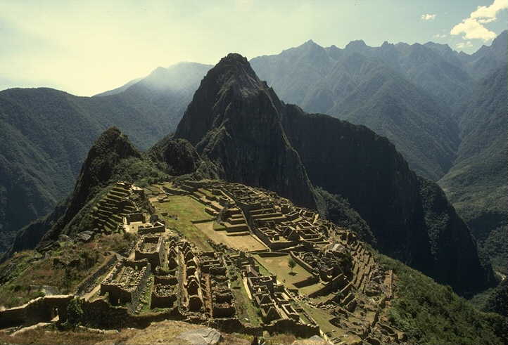
Machu Picchu (literally means "old peak"; sometimes called the "Lost City of the Incas") is a well-preserved pre-Columbian town located on a high mountain ridge, at an elevation of about 6,750 feet (2,057 m) above the Urubamba Valley in modern-day Peru. The site is probably the most familiar symbol of the Inca Empire, both due to its unique location, its geological features, and its late discovery in 1911.
Archeological evidence (together with recent work on early colonial documents) shows that Machu Picchu was not a conventional city, but a country retreat town for Incan nobility. It is estimated that a maximum of only about 750 people resided in Machu Picchu at any one time, and probably only a small fraction of that number lived in the town during the rainy season and when no noblity were visiting. It is thought that the site was chosen for its unique location and geological features. It is said that the silhouette of the mountain range behind Machu Picchu represents the face of the Inca looking upward towards the sky, with the largest peak, Waynapicchu, representing his nose. The Inca believed that the solid rock of the Earth should not be cut and so built this city from rock quarried from loose boulders found in the area. Some of the stone architecture uses no mortar, but rather relied on extremely precise cutting of blocks that results in walls with cracks between stones through which a credit card will not pass. |